Flood in Highlands-Kontum - Part 1
Flooding in Highlands - Kontum
Kon Tum is the capital of the province of the same name. It is one of five provinces in the central highlands of Vietnam, near the borders of Laos and Cambodia where more than 53% of the population are ethnic minority, including Sedang, Jarai, Bahnar, Rongao, Jeh-Trieng, Hre, Brau, Rmam, etc... Their main economic activity is agriculture.
In Bahnar language, kon means village and tum means temporary lake or pond, created by the Dakbla river overflowing. So, Kontum is the village with surrounding temporary lakes.
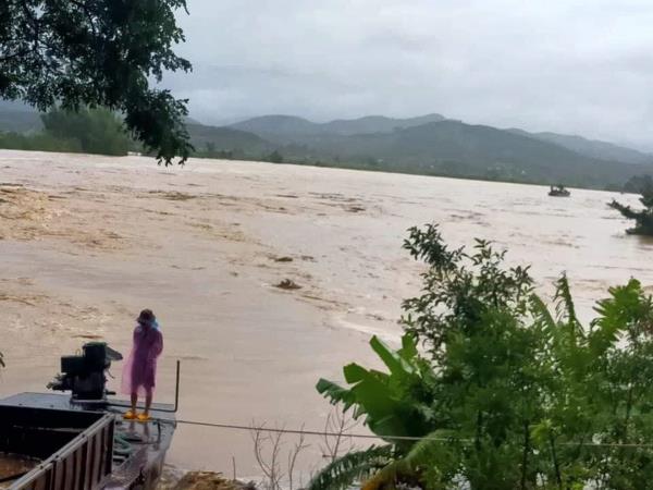
This is overflowing Dak Bla river on October 28th, 2020, viewed from the bank near my village. All the fields from the village on the opposite bank are underwater. My parents could not go back there for two or three days. Fortunately, their crops were not destroyed as they were in other flooded parts.
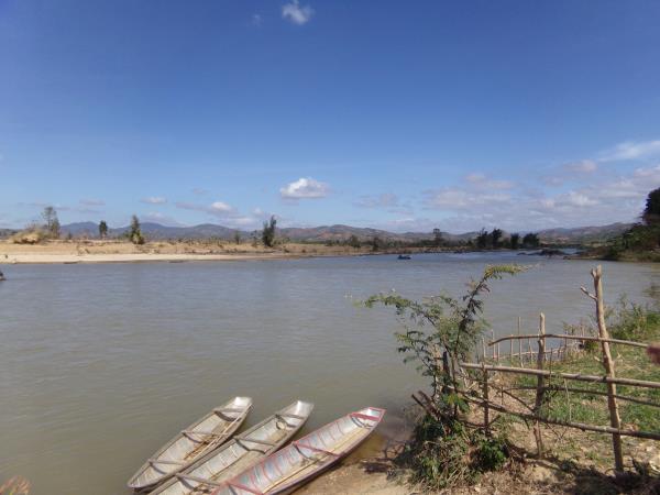
On this picture from January 2018, shot from a point not so far away from the one above, you can see the actual width of the Dak Bla river, inferior to 100 meters and not very deep at this location, to the point that an average person can cross it on foot.
See also this video, originating from the same period of 2020, of the main Kontum bridge and the water nearly reaching the deck, something like 5 meters above its usual river level: https://www.youtube.com/watch?v=BxAPeeueLZQ
For those who think that our highlands are not concerned with floods, check this old picture of a flood in Dalat in 1932. We have also been told by people from the Talai (Đồng Nai) Maa' village that some of its current residents (originally ethnic Maa' Krung) were relocated there after their village was completely destroyed by a sudden flood (around the 1950s') that killed tens of its former inhabitants.
Read the Bahnar version
- b.roihkra's blog
- Log in to post comments
- Français